News
Hurricane Hermine Is Headed For Florida
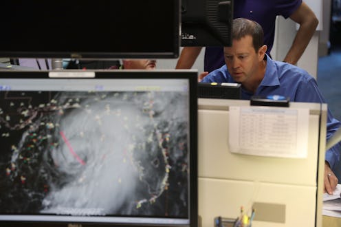
As Tropical Storm Hermine picked up strength on Thursday, it quickly turned into a hurricane, which will soon hit Florida's Gulf Coast and northern inland region. Hermine is the first hurricane to hit Florida since 2005, with winds strengthening to 75 mph on Thursday afternoon. As the state prepares for the potential damage to follow, how will Hurricane Hermine affect Florida?
Hermine is the fourth hurricane of 2016 to hit the Atlantic Basin — aka the region surrounding the Gulf Coast — and Florida is right in the center of the storm's path. The Sunshine State will likely face the most damage from the storm, which will continue heading north and east toward Georgia, South Carolina, and North Carolina, with its impact possibly reaching as far up the East Coast as New Jersey and New York. While the hurricane's center was focused on Florida's Gulf Coast, the Weather Channel notes that Hurricane Hunters found that the impact of the storm would stretch further east, which prompted weather warnings along both coasts of the state and as far south as Naples.
Florida Gov. Rick Scott issued a state of emergency on Wednesday, but was quick to update the state's residents when the storm developed into a hurricane on Thursday. In a press release, Scott said:
This storm has the potential to be life-threatening if residents and visitors don’t follow proper precautions to protect themselves and their loved ones. This storm will impact the majority of our state. Right now, we are concerned about storm surge in our coastal communities, wind, rain and tornadoes. We can expect storm surges beginning this afternoon along the Nature Coast and the Big Bend, wind speeds up to 75 mph, rainfall of up to 15 inches in some areas and tornados impacting Central and North Florida.
The storm could have devastating effects across the state.
Rainfall in Florida could add up to 10 to 20 inches, while storm surges and tides "could push 1 to 8 feet of water" into coastal areas, according to CNN. Lake Smith, a contractor in Apalachicola, told CNN, "Storm [surge] is what got me worried right now. Mostly worried about washing out the roads and a few of the homes in low-lying areas."
As for some of the more central parts of the state, strong winds have the potential of turning into tornadoes, which has prompted tornado warnings across that region, which will remain in effect until 11 p.m. ET Thursday night. The cities at a heightened risk for tornadoes include Tampa, Orlando, Ocala, Melbourne, Gainesville, Jacksonville, Daytona Beach, and Tallahassee, according to AccuWeather.
The state should also be prepared for potential power outages, AccuWeather noted. In that regard, Scott noted in his statement, "Anyone in the storm’s path must have ready the resources your families need such as water, flashlights, batteries and medicine. Power could be out for days or even weeks. That is why you have to be prepared with all of these resources."
