News
Hurricane Models For Matthew's Path Of Destruction
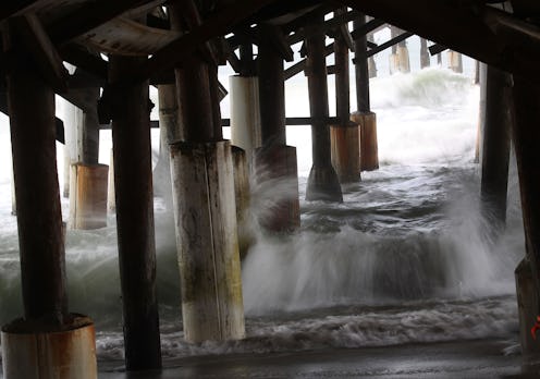
Hurricane Matthew ripped through the Dominican Republic, Haiti, and the Bahamas this week, killing at least 16 people, and now U.S. officials are in the process of heavily monitoring the pathway of the Category 3 storm. Hurricane models for Matthew suggest that the Florida coast will suffer from the greatest impact stateside, though multiple states along the East Coast are also preparing their residents for the storm. As of Thursday morning, the National Weather Service is warning of life-threatening storm surges, high-impact winds, and flooding rainfall for Florida, Georgia, and the Carolinas, with the possibility of a one-two punch to the east coast.
The strongest prediction model for Matthew currently suggests "catastrophic" damage to Florida, with Governor Rick Scott urging residents to "evacuate, evacuate, evacuate." Hurricane Matthew is expected to make its way to the eastern coast of Florida by late Thursday and into Friday, with the possibility of the storm lingering to Sunday. At its peak, wind speed is expected to reach a staggering 75 miles per hour, though winds in the Bahamas reached 125 miles per hour. Models likewise suggest that the storm will move back into Category 4 as it approaches the coast.
Weather.com notes that the hurricane won't actually have to cross over land for it to cause extensive damage. The eye wall, which surrounds the center of the storm, causes the greatest surge in winds, meaning that Florida may be hit with hurricane conditions even if the storm stays some 20 to 30 miles out. This is drawing concern from officials — if the hurricane doesn't reach landfall, it likely won't weaken offshore.
Some models for the hurricane are also expecting a one-two punch, with predictions that Matthew will first hit Florida, move into the Atlantic Ocean, then circle back to Florida again for a second landfall.
According to models predicting the continuing pathway of the storm, Matthew is also expected to reach coastal sections of Georgia, as well as parts of North and South Carolina. Some of these areas have also received mandatory evacuations, as the storm is predicted to hit late Friday into Saturday.
South Carolina Governor Nikki Haley has ordered all lanes of Interstate 26 to travel west of Charleston, hoping to move thousands of residents away from the coast. The same destructive winds and surges expected to hit Florida will likely also cause extensive damage to the states' coastal regions.
Residents in all affected areas are strongly encouraged to take extreme precautions. Florida Governor Rick Scott urged: "There are no excuses. You need to leave. This storm will kill you. Time is running out.
