News
Hurricanes Are Categorized According To A System
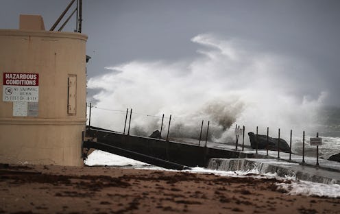
Hurricane Matthew is on track to reach Florida, and it may well end up being the strongest storm to hit the United States in over a decade. As of this writing, it’s a Category 4 storm, and it’s possible that it could enter Category 5 territory before it’s over. But let’s back up a bit — what do the hurricane categories actually mean?
The spectrum on which hurricanes is ranked has a name: The Saffir-Simpson Hurricane Wind Scale. As its name implies, the Saffir-Simpson scale ranks hurricanes based on their sustained wind speed, and uses this to estimate how much property damage they’ll incur. Here’s how the scale works, courtesy of the National Weather Service:
A Category 1 involves winds of 47 to 95 mph with some damage to roofs, trees, and power lines.
A Category 2 storm entails winds of 96 to 110 mph with major damage to roofs, uprooting of shallow-rooted trees, some road blockage, and near-total power loss.
Even stronger, a Category 3 hurricane is defined by 111 to 129 mph winds with devastating damage to well-framed homes, widespread uprooting of trees, road blockage, and loss of electricity and water.
And like Matthew, a Category 4 storm means there are 130 to 156 mph winds along with catastrophic damage to well-framed homes, uprooting of most trees, isolation of residential areas, weeks- to months-long power outages, and potential uninhabitability of the affected areas.
Lastly, a Category 5 hurricane has 157 mph winds or higher and can cause total destruction of many well-framed homes, downed trees, and power outages. In addition, residential areas could be rendered isolated and uninhabitable.
Matthew is expected to have winds of around 140 mph at its peak, which would put it squarely in Category 4, and given its expected trajectory, the entire east coast of Florida is at risk of serious damage as the storm makes its way through the state. It’s not just Florida, either: Matthew is expected to hit the coasts of Georgia and South Carolina as well before returning to the Atlantic Ocean late Sunday.
“Extremely dangerous, life-threatening weather conditions are forecast in the next 24 hours,” the National Weather Service wrote on Thursday morning. “Airborne debris lofted by extreme winds will be capable of breaching structures, unprotected windows and vehicles.”
This is, in other words, a legitimately dangerous situation. Matthew already killed over 260 people in Haiti as it made its way toward the states, and evacuation orders have been issued to around 2 million people, including over 1.5 million in Florida alone. Here’s a list of which areas are being evacuated — but if you live in any of the affected states, you should continue to monitor the National Weather Service for safety advisories.
