News
Hurricane Matthew Heads Towards The Southeast
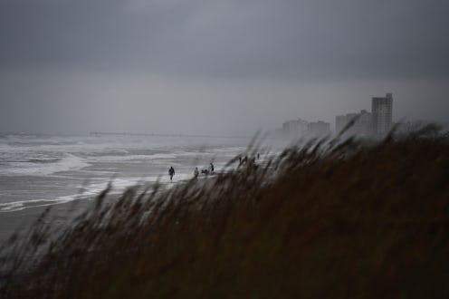
The path of a hurricane isn't the most predictable thing to track, but Hurricane Matthew's radar suggests it will hit the Southeastern coast of the United States later this week. The most powerful tropical storm since 2007, Matthew has already claimed the lives of at least 25 people, NBC reported. After devastating Haiti and Cuba, the storm has made its way over to parts of the Central Bahamas, but won't stop there. If you were looking for a reason to take this storm seriously, this is it, especially if you are or will be in Florida, Georgia, or the Carolinas later this week.
Hurricane Matthew is estimated to impact Florida from late Thursday to Friday, and possibly up until Saturday, The Weather Channel reported. The storm should hit Southeastern Georgia on Friday and Saturday, and the Eastern Carolinas from Friday possibly up until Sunday.
It was earlier reported that Matthew would likely hit the northern East Coast, but now, forecasters are reporting that the storm could circle off the Southeast Coast of the United States instead of heading northward. Of course, nothing is set in stone, so if you live on the northern East Coast, you should still absolutely have an evacuation plan.
Hundreds of thousands are evacuating coastal parts of southeast states in advance of Matthew's arrival. In preparation for the storm, Florida's governor, Rick Scott, announced that 1,500 members of the National Guard have been activated. And if you're trying to evacuate by car in Florida, don't worry about fees. Drivers in Florida won't be charged tolls on major roadways leading out of the region, including the Florida Turnpike, officials told NBC.
The impacts of a tropical storm as forceful as Matthew can be immense. Forecasters expect huge waves, beach erosion, and coastal flooding, aside from the damage it will likely inflict upon structures along the coastline. To put this storm's power into perspective, waves could get as high as eight feet above ground level from the Sebastian Inlet to the Savannah River.
Florida's eastern coast will likely experience hurricane-force winds (which are 74 mph or more) starting Thursday night, forecasters said. More inland areas may experience tropical storm-force winds (39 mph or more). But it's important to keep in mind that both storm-force winds and hurricane-force winds can lead to structural damage, such as trees being knocked down and mass power outages, as well as rainfall flooding and tornadoes, The Weather Channel warned.
Without storm radar, tracking a storm's trajectory would be exceptionally difficult. Fortunately, forecasters use a number of tools to predict where these massive storms will travel next. For example, they track storms and collect data using satellites, reconnaissance aircraft, and balloons. They also use data, such as temperature, humidity, and wind speed to make computer forecast models. Since the data is constantly being updated, forecasts may change quite abruptly. If you're in an area that may be impacted, if could be a good idea to keep track of Matthew's whereabouts and conditions through a storm tracker.
