News
15 Scary Hurricane Harvey GIFs That Warn It’s Getting Closer & Closer To Land

No matter how many pictures you see or articles you read about an oncoming storm, nothing seems really real until you actually see it in real life — or, at least, until you see videos of it. And believe me, there are plenty of scary Hurricane Harvey GIFs that will convince you that this thing is actually a threat. If you're anywhere near the area where Harvey might hit, now's the time for you to evacuate as quickly as possible — and if you need any convincing, just look at these clips.
If you're anything of a weather nerd, you'll know that a lot of these terrifying radar images are only projections and predictions — but it's pretty clear that there's at least going to be a lot of rain, and that means a lot of flooding potential. As you can see from some of these GIFs, the water's already getting choppy along the Texas coast, and emergency services are already clustering in the areas where they'll most likely be needed. Remember, Hurricane Harvey will probably be the worst hurricane to hit Texas since 1999 — so this is a serious situation, and we all need to remember to take it as such.
1The Calm Before The Storm
Sure, it just looks like a pretty sunset — but it was this smooth sunset cruise that helped the weather service upgrade the storm to a Category 2 hurricane.
2The View From Space
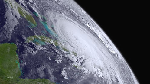
Radar images are one thing — views from the space station are something totally different. When you see that the clouds from the storm take up basically the station's entire view of the Earth, it really looks serious.
3Getting Prepared
The sheer number of emergency personnel who will be on hand should make anyone think twice about staying anywhere near the hurricane's path.
4Taking Care Of The Most Vulnerable
Corpus Christi is right in the path of the storm, so they're not taking any chances. They haven't ordered a full evacuation of the city, but the most vulnerable people are being taken to safer ground — and by most vulnerable, I mean the babies in the neonatal intensive care unit in the city's main hospital.
5People Are Taking This Seriously
It doesn't look pleasant to be stuck in that line of traffic, but getting stuck in traffic is better than getting stuck in a flooded house.
6Listen To The Experts
You might just see bunch of clouds moving in formation, but this weatherman sees a well-defined eye and a lot of open water for the storm to pick up steam.
7Know The Threat
It's not just the winds and rain that could prove dangerous — it's the storm surge, and the National Weather Service has issued a warning about it for the first time.
8Trust The Color Coding
This clip shows it all — the extreme pinks and reds in the first image, and the menacing clouds moving ever so slowly closer to the coast in the second.
9Note The Cities
The maps often just show you the coastline without any markers of where people actually live, but here you can see how close it's going to get to Corpus Christi, a city of over 325,000, and Port Lavaca, which another 12,000 call home. If you know your Texas geography, then you know that both of those are practically villages compared to the huge metropolis only miles away: Houston, population 2.3 million.
10More Storm Surge Education
While it's not exactly pleasant to watch a meteorologist in front of a green screen of a house flooding, it's important to know what exactly the storm surge is capable of doing. She successfully makes the point that there are few forces on Earth as powerful as water that has nowhere else to go.
11Just Look At The Size Of That
If you needed any more convincing that this storm is huge, well, here's the evidence.
12It's Not Just Houston
Hurricanes, particularly big ones like Hurricane Harvey, aren't generally contained to a small area. That may seem like an obvious thing to say, but I'm specifically talking about the weather disturbances and heavy rain that can come even outside of the area that the storm itself is technically hitting. If you're in south Texas at all, at the very least you're going to need a good umbrella this weekend.
13A View From The Ground
This was shot right near Port Lavaca, and you can already see how fast the waves are moving in. Hopefully, the people watching the waves in the video have already gotten themselves safely out of the area.
14Watch Those Colors Again
You've probably heard various meteorologists talking about how the storm could upgrade as it moves over the open water, and watching the radar get progressively redder and redder is just another way of imagining that.
15The View From The Eye
If you grew up anywhere along the Atlantic coast or the Gulf of Mexico, you know a thing or two about hurricanes. And if you know anything about hurricanes, you know that the eye is where there's a moment of calm — and this is what it looks like inside the eye of Hurricane Harvey. The plane looks quite steady — perhaps it's best not to imagine the rough winds it'll face as soon as it goes into the area right around the eye, where the winds are the strongest.
Hurricane Harvey's projected landfall is now less that 24 hours away, and unless it somehow weakens, this is going to be a big deal. If you see your town anywhere near those red sections on the radar, you're going to want to get out as soon as you possibly can.