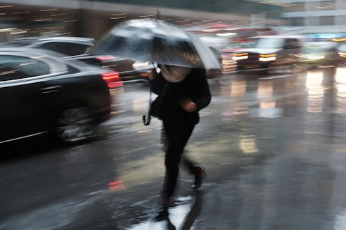
Better get your umbrellas ready, because three U.S. cities could see a lot more rain this fall than they usually do. According to AccuWeather Long-Range Meteorologist Paul Pastelok, cool air coming down from the north could result in “a focus down along the southeast coast of Texas and Louisiana getting a little more active this season” — which means that some cities in those areas might see an increase in rainfall of up to 60%.
Per a recent report on AccuWeather’s website, the cities in question are Houston, Texas; Little Rock, Arkansas; and Albuquerque, New Mexico. For Houston and Little Rock, rainfall that’s 30 to 60% higher than usual could be on the way this fall; for Albuquerque, the figure is 30 to 45%. Rainfall in Little Rock has also already been 31% above normal between May 1 and Aug. 4. And no matter what the precise figures are for each location, the bottom line is that they’ll be dealing with far more water plummeting down from the sky than usual — which, depending on how things shake out, could have some concerning consequences.
The trend isn’t isolated, though. Between June 2018 and June 2019, the United States saw the wettest 12-month period on record, with the average precipitation across the contiguous states during that time measuring 37.86 inches, according to the National Centers for Environmental Information. That’s 7.9 inches above average; also, when I saw “wettest 12-month period on record,” that record covers 125 years — a full century and quarter.

The kicker is the fact that this marked the third time this year that the total amount of precipitation made it the wettest 12-month period on record. The record had previously been broken in May, when the 12-month period between June 2018 and May 2019 clocked in at 37.72 inches — and before that, the record was held by the May 2018 to April 2019 period, which measured 36.31 inches.
As Climate Central, an independent organization of scientists and journalists that conducts scientific research on climate change and gets their key findings out to the public, observed in a brief dated May 15, 2019, climate change is largely responsible for the continued uptick in rainfall we've been seeing in recent years; it is, as they put it, “making the wettest days wetter” and “heightening floor risks.” They point out that in 2019 alone, floods across the Midwest damaged infrastructure and crops to the tune of billions of dollars, record downpours and mudslides put Tennessee in a state of emergency, and in northern California, heavy precipitation damaged thousands of buildings — not to mention all of the people hurt, displaced, or killed in these and other similar events.
The heavy rains intensified by climate change come as a result of two main factors: The rate at which water evaporates from the ocean (from which about 60% of the water vapor that “feeds precipitation” comes), and how much moisture the atmosphere can hold. As the Climate Reality Project explains, “the rate of evaporation from the ocean is increasing as the world warms,” while at the same time, “as the atmosphere gets warmer, it can hold more moisture.” The more moisture is held in the atmosphere, the heavier the precipitation is — and with both increasing at dramatic rates, the more extreme our weather events become. What’s more, as NASA points out, areas that are already often affected by storms are more likely to experience increased precipitation and flood risk, while areas that don’t tend to be located near storm tracks are more likely to experience an increased risk of drought.

In short: Wet places get wetter; dry places get dryer; and everyone loses.
Indeed, AccuWeather’s long-range forecast for the fall also brings up the areas that will experience the opposite of what’s expected in Houston, Little Rock, and Albuquerque: Pendleton, Oregon and Bangor, Maine. Said Paul Pastelok, “The Pacific Northwest and the Northwest, the Cascades, and just east of the Cascades, I think that’s where the worst of the dryness and the heat is going to continue to go on.” Remember that heat wave that hit back in July that was so bad, it was 90 degrees in Alaska? We can probably expect more of that sort of weather in locations not prone to rainfall in the future.
Not going to lie: The outlook is pretty bleak. So, uh, now might be a good time to support legislation geared toward mitigating or reversing climate change, make an effort to stay informed, and work on some strategies for coping with climate change anxiety. We’ve only got one planet, after all, and even though the deck regularly seems stacked against us, the fight to save it isn’t over yet.
